The Highlands
Updated · BootsnAll
The Highlands are Iceland's empty middle: no towns, no gas stations, almost no plants, and a short summer window when the roads are open at all. People come for the glaciers and volcanoes, the rhyolite hills at Landmannalaugar, the long hikes, and the feeling of being very small and very alone. You need a proper four-wheel drive or a seat on a bus or tour to get in, and some planning either way.
What the Highlands are like
Most of the interior is volcanic desert. Rain soaks straight into the porous ground, so little grows, and the land is grey, black or brown ash, gravel and old lava. Many of Iceland's glaciers and volcanoes sit up here, along with valleys that look like another planet. There isn't much wildlife either, for the same reason there aren't many plants. What you get instead is scale and silence.
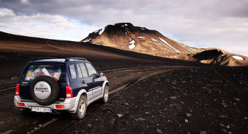 The season is short. Safetravel says the highland F-roads are usually closed from mid-September until June or July, and each road opens on its own schedule depending on snow and mud. Check the live map at umferdin.is (or call 1777) before you set off, not the week before.
The main highland routes
Kjölur
Kjölur, officially Kjalvegur (road 35), starts behind Gullfoss in the south and comes out near Blönduós in the north, running between the Langjökull and Hofsjökull glaciers. Vegagerðin's road register puts the gravel stretch at about 167 km, and it takes around five hours. The road is rough, but the rivers are bridged, and the road authority says it has lost its F-road status after improvements, which makes it the easiest full crossing. Check your rental contract anyway. The geothermal area at Hveravellir, roughly halfway, is the natural place to stop.
Sprengisandur
Sprengisandur (Sprengisandsleið, F26) is the long, lonely one, crossing the plateau between Hofsjökull and Vatnajökull from the south to the north. The F-road section alone, from near Þórisvatn lake to Bárðardalur in the north, is about 155 km in the road register, with more gravel before it. On a clear day you can see the glaciers and, far to the northeast, Askja and Herðubreið. Vegagerðin says it doesn't fully open until early July, sometimes later, and then only for large four-wheel-drive vehicles. The hut and ranger station at Nýidalur, along the way, is the place to ask about conditions.
Kaldidalur
Kaldidalur (Kaldadalsvegur, road 550) is the shortest route, often called the "Highlands for beginners." It branches off road 52 north of Þingvellir and runs about 40 km, according to Vegagerðin's road register, between the Þórisjökull and Ok glaciers, coming down in Borgarfjörður at Húsafell. It isn't an F-road and has no unbridged rivers, but many rental companies still don't allow two-wheel-drive cars on it, so read your contract. Like the other mountain roads, it only opens once the snow has gone; Vegagerðin explains how that works on its page about mountain road openings.
The roads to Landmannalaugar and Askja
Landmannalaugar is reached on F-roads from the south: Ferðafélag Íslands lists F208 and F225 as the ways in. Askja, in the northern Highlands, is a long drive on F-roads south of the Ring Road, and like the other highland roads they usually open only in June or July.
Things to see and do
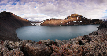 Hiking and glacier walking are the main reasons people come, but you can see a lot of the Highlands from a car or bus window too.
Landmannalaugar and the Laugavegur trail
Landmannalaugar is the Highlands' best-known stop: hills streaked pink, green, yellow and brown, lava fields, and a natural hot spring right by the hut where you can soak after a hike. Most people come for a day. If you have more time, walk the Laugavegur trail, 55 km from Landmannalaugar to Þórsmörk, usually done in four days. Ferðafélag Íslands runs six huts along it and expects hikers to have hut or campsite bookings confirmed before they start. Its average season runs roughly June 25 to September 15.
The glaciers
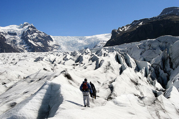
Vatnajökull, the largest glacier in Iceland, and Langjökull, the second largest, both edge into the Highlands. You can look at either on your own, but don't walk on a glacier without a guide. Crevasses are hard to see, and conditions change fast.
Askja
In the north, the main draw is Askja, a set of nested calderas where American astronauts trained in the 1960s because the terrain was thought to look like the Moon. Its last eruption was in 1961. The ground there rose from 2021 as magma moved underneath, but in August 2026 the Met Office said the uplift had stopped and lowered Askja's alert level to normal; steam explosions can still happen in its geothermal areas. A guide is a good idea, and many visitors come on tours from Lake Myvatn or Akureyri.
Where to stay
Apart from a few farmstays on the edges, your choices are campsites and mountain huts. There are no hotels in the interior. At Landmannalaugar, the Ferðafélag Íslands hut and campsite are what's there, and most people visit on a day trip. The association runs about 40 huts around the country. They're simple: bring a sleeping bag, food and drink. A camper van is the other option, as long as it's four-wheel drive and allowed on F-roads.
Getting there without your own 4x4
This is how I'd recommend most first-timers do it. The Highland Bus from Reykjavik Excursions runs from Reykjavik (BSÍ and the city hostel) to Landmannalaugar, Þórsmörk and Skógar from early or mid-June to mid-September, with stops in Selfoss, Hella and Hvolsvöllur. There are no guides on board; it just gets you there. As of 2026, the Landmannalaugar bus starts at 10,999 ISK one way.
Trex runs a similar service. Its 2026 season ran June 19 to September 6, with Landmannalaugar or Þórsmörk from Reykjavik at 14,900 ISK, and a Hikers Bus Pass at 27,900 ISK that covers the Laugavegur start and finish.
If you'd rather have a guide, day tours from Reykjavik run long. Icelandia's Landmannalaugar day trip, for example, takes about 11 hours and costs 28,000 ISK as of 2026. See our pages on day tours from Reykjavik and tours in northern Iceland for more.
Tips for driving in the Highlands
- F means four-wheel drive. F-roads are for 4x4s only, and Safetravel warns that not every 4x4 is up to every F-road. Some need a Land Cruiser, a few need a modified superjeep.
- Stay on the road. Off-road driving is strictly forbidden. Tyre tracks in moss last for decades.
- Rivers are the real danger. No insurance covers damage from a river crossing. If you aren't sure, don't cross. Wait for another car or turn back.
- Fuel up first. There are no gas stations in the interior.
- Tell someone. Leave a travel plan with Safetravel and check the weather the morning you go.
For the rest of the rules on the road, see driving in Iceland and car rental in Iceland.
FAQ
Can I drive into the Highlands in a normal rental car?
Not on F-roads. Kaldidalur isn't an F-road, but many rental contracts still ban two-wheel-drive cars from it, and damage there usually isn't covered.
When are the highland roads open?
Roughly late June or July to mid-September, varying by road and by year. The live status is on umferdin.is.
Is there a hotel at Landmannalaugar?
No. There's a Ferðafélag Íslands mountain hut and a campsite. Book ahead in July and August.
Photos by: Michal Scaharewicz, Michal Scaharewicz