Hiking in the Hengill Geothermal Area
· Updated · BootsnAll
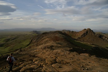 Hengill is a volcano that lies in Iceland’s western volcanic belt, about 20 minutes from Reykjavik. Though the last eruption was about 2000 years ago, the volcano is still active and the area surrounding it is one of high geothermal activity. In fact, a great deal of the country’s energy comes from the area, and is captured at the Nesjavellir and Hellisheiði power stations, operated by ON Power, part of Reykjavik Energy.
For tourists the area is of interest for two reasons. The first is the Geothermal Exhibition at the Hellisheiði Power Plant, about 25 km east of Reykjavik, which is open year-round and has audio guides and guided tours for groups. And the second is for the many hiking opportunities in the Hengill area. The rolling hills and mossy lava fields are dotted with boiling hot springs and steaming fumaroles, and are crossed by around 130 km of marked trails that range in difficulty from very easy and flat to steep and difficult.
It’s easy to come hike the trails on your own; there’s a hiking hut at Múlasel for those who want to do multi-day treks. However, due to the unstable nature of the environment, it’s not recommended for inexperienced hikers to come alone.
If you do hike, here are a few things to be aware of:
- The hot springs can reach boiling temperatures. Approach hot springs with caution and always check the temperature before going in
- Cell reception in the area is quite good, but always hike with a GPS or a compass and map
- There are no gas stations close to Hengill (except in the town of Hveragerði) so be sure to fuel up before driving around the area
- Off-road driving, campfires, and unleashed dogs are prohibited, and camping is only allowed in designated areas
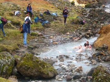 If you aren’t up for hiking the area on your own, the My Reykjavik evening hike I used to recommend no longer runs, but several Reykjavik tour companies offer guided hikes to Reykjadalur, a valley on the Hveragerði side of Hengill. The trail from the parking area above Hveragerði is about 3.5 km (2.2 miles) each way and passes steaming springs and mud pots on the way up.
At the top, hot springs flow into a stream, making for a pleasantly warm river you can bathe in. There are simple screens to change behind, but no changing rooms, so come prepared.
Photos by Terje Solbakk, Blue Funnies